Austin Paddle Boarding, Kayaking & Canoeing
Contents
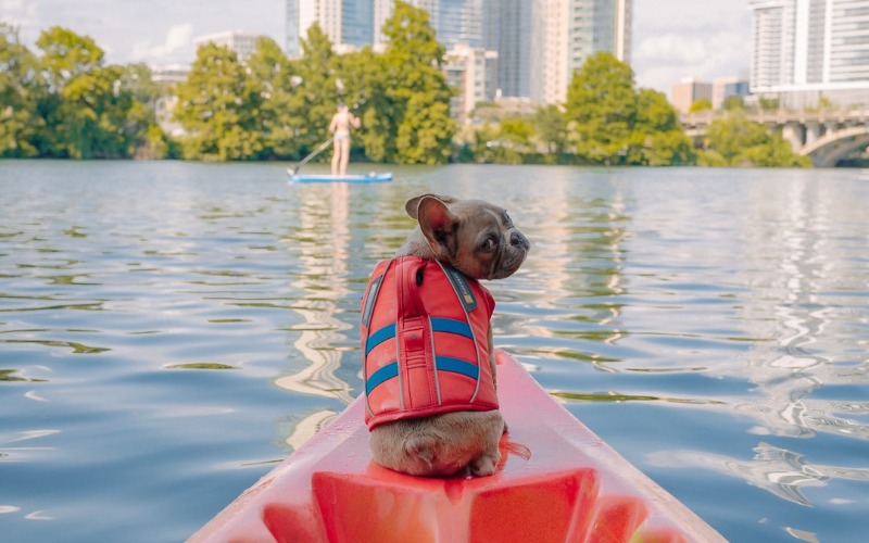
Paddling in Austin Texas is one of the best ways to get away and unwind from your daily grind, with options ranging from peaceful urban waters to river rapids. There’s so much to do on Austin’s waterways that you’re sure to find something that suits your interests and skill level.
Paddling Town Lake
Town Lake is a calm and placid lake that divides the northern and southern parts of the city of Austin. At the west end of the lake is Red Bud Isle and Tom Miller Dam. At the east end of the lake is “Bird Island” and Longhorn Dam. Between the two dams lies an approximately 10-mile stretch of the Colorado River. The lake is home to several species of fish, as well as numerous birds. The lake is perfect for canoeing and kayaking. You can leisurely paddle your canoe or kayak, race your sprint boat, play kayak polo underneath the Mopac bridge, fish from your boat, or practice your freestyle canoe maneuvers.
- Class: Flatwater lake
- Location: Austin, Texas (Mapsco 584A to 615M)
- Directions:
- From Mopac (Loop 1), exit 1st Street.
- From IH-35, exit Riverside Drive.
- Put Ins and Take Outs:
- Festival Beach boat ramp
- IH-35 boat ramp
- Austin High boat ramp
- Red Bud Isle
Lake Austin Paddling
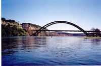
Lake Austin is a calm lake that is one of six reservoirs in the Highland Lakes chain. At the west end of the lake, you’ll find Mansfield Dam, scenic views, and wildlife. At the east end of the lake, you’ll find luxurious homes, on-the-water restaurants, and Tom Miller Dam. The lake is home to several species of fish, including sterile carp, and hydrilla. You can leisurely paddle your boat on the west end of the lake, but as you approach City Park and continue further east you’ll encounter a great deal of motor boat traffic (summer months), wakes, and waves. The lake is suitable for longer recreational, touring, and sea kayaks. Canoes usually have to put up with a lot of headwind!
 Class: Flatwater lake (1,609 acres)
- Location: Austin, Texas (Mapsco 491, 520, 521, 522, 523, 524, 554)
- Directions:
- From RM 620, exit Low Water Crossing Road or Mary Quinlan Park Road.
- From RM 2222, exit City Park Road.
- From Loop 360, exit access road for boat ramp.
- From Enfield Road, exit Scenic Drive.
- Put Ins and Take Outs:
- Low Water Crossing Road
- Mary Quinlan Park
- Commons Ford Metropolitan Park
- City Park
- N. Capital of Texas Highway (Loop 360 bridge)
- Walsh Boat Landing
 Class: Flatwater lake (1,609 acres)
On nice weather days, with a lot of motor watercraft, this lake can be more difficult to paddle than Lady Bird Lake. Lake Austin is 20 miles long and features stunning scenery, hundreds of spectacular homes, and numerous inlets to explore. Surfing boat wakes is another option on Lake Austin, but because the lake is relatively narrow, going out when the lake is not crowded is preferable.
Paddling Lake Travis
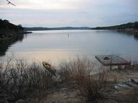
Lake Travis can be a wild and woolly lake. Like Lake Austin, it’s one of six reservoirs in the Highland Lakes chain. At the west end of the lake, you’ll find Max Starcke Dam. At the east end of the lake, you’ll find Mansfield Dam. It’s home to countless motor boats, personal watercraft, and sailboats. The lake is suitable for longer recreational, touring, and sea kayaks. Of course, you could always hop on a sit-on-top or in a recreational boat and paddle in the coves.
- Class: Flatwater lake (18,622 acres)
- Location: Austin, Texas (Mapsco 428, 458, 459, 488, 489, 490, 460, 461, 491)
- Directions:
- From RM 620, exit FM 2769.
- From RM 2222, continue until the road dead ends into FM 2769.
- From RM 620, exit Mansfield Dam.
- Put Ins and Take Outs:
- Cypress Creek Park
- Mansfield Dam Park
 Class: Flatwater lake (18,622 acres)
Lake Travis is the biggest of the Central Texas lakes and provides seemingly limitless opportunities for SUP paddle boarders. It would take several days to paddleboard around Lake Travis. This lake is also ideal for SUP boat wake surfing.
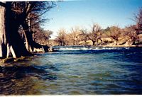
San Marcos River Paddling
Just 30 miles south of Austin is the spring-fed San Marcos River. The San Marcos offers lush vegetation and a constant water flow, even in the hot, dry summer months. Watch for strainers and dams. The river has three major rapids below Pecan Park: Old Mill, Broken Bone, and Cottonseed. Recreational kayaks, whitewater kayaks, and canoes are suitable for the river.
- Class: Moving water, I – I+
- Location: San Marcos, Texas
- Directions: Go south on IH-35. Exit Hwy. 80.
- Put Ins and Take Outs
- City Park to Rio Vista Dam
- City Park to Pecan Park
- Pecan Park to Sculls Crossing
- Pecan Park to 1979 (Spencer’s in Martindale)
 Class: Moving water, I – I+
The 30-minute drive to San Marcos, Texas, is well worth it. Your adventure begins at City Park, where the slower, lazy river water is ideal for beginners. If you’re looking for something more adventurous, once you leave downtown, you’ll find yourself in conditions better suited to experienced kayakers or professionals. The current picks up speed, and you’ll encounter Class I and Class II rapids on a regular basis.
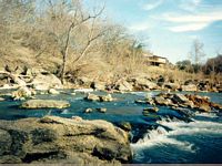
Upper Guadalupe River
The Upper Guadalupe winds through cliffs and cypress trees, and carries you by travertine waterfalls, and interesting rock and river formations. The sections of the Guadalupe above and below the Guadalupe River State Park have several rapids and waterfalls. Recreational kayaks, whitewater kayaks, and canoes are suitable for the river.
- Class: Moving water/whitewater, Class I – II
- Location: Hunt (north end) to Canyon Lake (south end), Texas
- Directions: Go south and west on U.S. Hwy. 290. Go south on U.S. Hwy. 281. Go west on Hwy. 46.
- Put Ins and Take Outs:
- Bergheim Campground to Guadalupe River State Park
- Guadalupe River State Park or Specht’s Crossing to Guadalupe Canoe Livery
- Guadalupe Canoe Livery to Rebecca Creek Road
 Class: Moving water/whitewater, Class I – II
Lower Guadalupe River
While the Upper Guadalupe is very scenic and remote, the Lower Guadalupe is more populated and commercial. Throughout the summer months, the river will be clogged with swimmers in inner tubes. Section III of the Guadalupe River has six major rapids: Hueco Springs, Slumber Falls, Clutter, Rock Garden, Gruene Crossing, and Dog Leg. In the winter months, look for slalom gates at Slumber Falls. Whitewater kayaks, canoes, and rafts are suitable for the river.
- Class: Moving water/whitewater, Class I – II+
- Location: New Braunfels, Texas
- Directions: Go south on IH-35. Exit Hwy. 46.
- Put Ins and Take Outs:
- First Crossing to Gruene Road
- Hueco Springs Campground to Gruene Road
- Gruene Road to Loop 337
 Class: Moving water/whitewater, Class I – II+
Kayakers of all skill levels will enjoy paddling the Guadalupe River, which features everything from calm water to Class III rapids. Because there are multiple access points to the river, you’re bound to see tubers, anglers, and kayakers enjoying the water here. It also doesn’t hurt that the Guadalupe River is springfed, so a kayaking trip down this highly regarded Texas waterway will be cool and crystal clear.
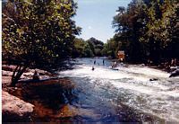
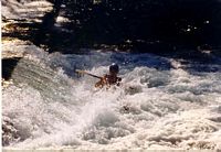
Rio Vista Dam
Rio Vista Dam, in the center of San Marcos, provides a forgiving hole in which you can side surf or throw ends. The San Marcos is spring fed and provides a consistent flow. Watch out for children and inner tubes in the chute.
 Class: Whitewater, Class I – II
- Location: San Marcos, Texas
- Directions: Go south on IH-35. Exit Hwy. 80.
- Put Ins and Take Outs: Rio Vista Park (by the tennis courts)
 Class: Whitewater, Class I – II
Longhorn Dam
Longhorn Dam, at the east end of Town Lake, provides a great surfing wave (when the LCRA releases water).
- Class: Whitewater, Class I – II
- Location: Austin
- Directions: From IH-35, exit Riverside Drive. Go east and turn on South Lakeshore Blvd. Turn north onto Pleasant Valley Drive.
- Put Ins and Take Outs: Krieg softball fields
Tom Miller Dam
Tom Miller Dam, at the west end of Town Lake, provides good surfing waves and ferries (when the LCRA releases water from the dam). You can also practice squirts on the downstream side of the Red Bud Trail bridge pilings. Watch out for rebar.
- Class: Whitewater (when the water’s turned on), Class I – II
- Location: Austin, Texas (Mapsco 584A)
- Directions: From Mopac (Loop 1), exit Lake Austin Blvd. Turn left on Red Bud Trail.
- Put Ins and Take Outs: Red Bud Isle
Whether you’re looking for an exciting kayaking getaway, a quick paddleboarding session, or a relaxing day of fishing, these Austin lakes and rivers are the perfect place to satisfy your thirst for the best paddling experience.